Canary Islands weather, month by month.
Highs, lows, sunshine, rain and the sea for Tenerife South, Gran Canaria, Lanzarote and Fuerteventura, from AEMET's 1991–2020 normals and NOAA's sea record. The islands differ less from each other than the north and south of any one of them.
The Canarian year is remarkably flat. At Tenerife South airport the average daytime high moves from 23°C in January to 29°C in August, and the other three airports stay within a degree or two of that. Between islands, the differences are a degree here and an hour of winter sun there. The big differences are inside each island. The north and south of the same island, and sea level against the mountains, are different climates.
The tables use AEMET's airport stations, which are low, coastal and on the east or south side of each island. Read them as resort-coast numbers, not as the weather in Puerto de la Cruz or up in the pine forest.
Day and night temperatures
| Month | Tenerife South | Gran Canaria | Lanzarote | Fuerteventura |
|---|---|---|---|---|
| January | 23 / 15 | 21 / 16 | 22 / 14 | 21 / 15 |
| February | 23 / 15 | 21 / 16 | 22 / 14 | 21 / 15 |
| March | 24 / 16 | 22 / 16 | 24 / 15 | 22 / 16 |
| April | 24 / 16 | 23 / 17 | 24 / 16 | 23 / 17 |
| May | 25 / 17 | 24 / 18 | 26 / 17 | 24 / 18 |
| June | 26 / 19 | 25 / 20 | 27 / 19 | 26 / 19 |
| July | 28 / 20 | 27 / 21 | 29 / 20 | 27 / 21 |
| August | 29 / 21 | 28 / 22 | 30 / 21 | 27 / 21 |
| September | 28 / 21 | 27 / 21 | 29 / 21 | 27 / 21 |
| October | 27 / 20 | 26 / 20 | 28 / 19 | 26 / 20 |
| November | 25 / 18 | 24 / 18 | 25 / 17 | 24 / 18 |
| December | 24 / 17 | 22 / 17 | 23 / 15 | 22 / 16 |
January and February are the coolest months everywhere, with days of 21–23°C and nights of 14–16°C. August is the warmest, at 27–30°C by day. Lanzarote has the widest swing: the hottest summer afternoons of the four (30°C in August) and the coolest winter nights (14°C). Tenerife South has the warmest winter days, 23°C. Hot spells happen, but they aren't the pattern. Days of 30°C or more range from 9 a year at Gran Canaria's airport to 33 at Lanzarote's, most of them between July and October, and none of the four averages even four days a year of 35°C or more.
Sunshine
| Month | Tenerife South | Gran Canaria | Lanzarote | Fuerteventura |
|---|---|---|---|---|
| January | 7.1 | 6.2 | 6.9 | 6.0 |
| February | 7.7 | 6.9 | 7.4 | 6.6 |
| March | 8.3 | 7.6 | 8.3 | 7.5 |
| April | 8.3 | 8.0 | 8.8 | 8.0 |
| May | 8.9 | 8.8 | 9.7 | 9.0 |
| June | 9.5 | 9.2 | 9.9 | 9.3 |
| July | 10.6 | 9.8 | 10.3 | 9.5 |
| August | 10.0 | 9.9 | 10.0 | 9.1 |
| September | 8.3 | 8.5 | 8.9 | 8.4 |
| October | 7.6 | 7.1 | 7.8 | 7.1 |
| November | 7.1 | 6.2 | 6.9 | 6.2 |
| December | 6.9 | 6.1 | 6.7 | 5.9 |
At Tenerife South, winter sunshine is about two-thirds of what is possible. On 15 January the sun there is up from 07:58 to 18:32, ten and a half hours, and the station records about seven of them as sunshine. Tenerife South and Lanzarote each log just over 3,000 hours a year; Gran Canaria's and Fuerteventura's airports, 2,800–2,900. In December and January that works out at roughly seven hours a day at the first two and six at the others.
Rain
| Month | Tenerife South | Gran Canaria | Lanzarote | Fuerteventura |
|---|---|---|---|---|
| January | 1.6 | 2.7 | 2.8 | 2.3 |
| February | 1.8 | 2.8 | 2.5 | 1.9 |
| March | 1.4 | 2.3 | 2.2 | 1.8 |
| April | 1.0 | 1.2 | 0.9 | 0.8 |
| May | 0.2 | 0.2 | 0.3 | 0.2 |
| June | 0.1 | 0.1 | 0 | 0 |
| July | 0 | 0 | 0 | 0 |
| August | 0.3 | 0.2 | 0.1 | 0.1 |
| September | 0.6 | 1.1 | 0.4 | 0.5 |
| October | 2.0 | 2.9 | 2.1 | 1.8 |
| November | 1.4 | 3.4 | 3.0 | 2.1 |
| December | 3.2 | 4.0 | 3.2 | 2.6 |
Rain is a winter event, and a small one. The four airports average 14–21 rain days and 84–132 mm in a whole year. December is the wettest month at all of them, with 19–33 mm. From May to September there are one or two rain days in five months. When winter fronts do come through, they can still make a mark: Tenerife South collected 188 mm in December 2002, against a December normal of 33.
The sea
The sea keeps its own calendar, a month or two behind the air. The air is warmest in August, the water in September and October. The coolest water comes in February and March. Off the south of Tenerife that means about 19°C at the bottom of the year and 24°C at the top.
It is also cooler than the latitude suggests. AEMET's marine climate atlas explains that the trade winds drive deep, cold water up along the north-west African coast, which keeps the sea surface colder than it would otherwise be. The eastern islands lie closest to that coast, and the water off Lanzarote and Fuerteventura is about a degree cooler than off Tenerife for most of the year.
| Month | Off Tenerife South | Off south Gran Canaria | Off Lanzarote | Off Fuerteventura |
|---|---|---|---|---|
| January | ≈20°C | ≈20°C | ≈19°C | ≈19°C |
| February | ≈19°C | ≈19°C | ≈18°C | ≈18°C |
| March | ≈19°C | ≈19°C | ≈18°C | ≈18°C |
| April | ≈19°C | ≈19°C | ≈19°C | ≈19°C |
| May | ≈20°C | ≈20°C | ≈19°C | ≈20°C |
| June | ≈21°C | ≈21°C | ≈21°C | ≈21°C |
| July | ≈22°C | ≈22°C | ≈21°C | ≈21°C |
| August | ≈23°C | ≈23°C | ≈22°C | ≈22°C |
| September | ≈24°C | ≈23°C | ≈23°C | ≈23°C |
| October | ≈24°C | ≈23°C | ≈23°C | ≈23°C |
| November | ≈22°C | ≈22°C | ≈21°C | ≈21°C |
| December | ≈21°C | ≈21°C | ≈20°C | ≈20°C |
As a cross-check, at the point AEMET's marine atlas uses for the open sea south of the western islands (27°N, 17°W), NOAA's averages and the atlas agree to within 0.2°C in every month. That atlas is the source behind our winter sea-swimming guide.
Why the north of each island looks different
The trade winds blow from the north-east, and they blow most of the time. AEMET's office in the islands puts them at about 90 percent of the time in summer and 50–60 percent in winter. Above them sits a temperature inversion: a lid of warmer, drier air that, in the words of AEMET's Izaña observatory, separates the moist marine layer from the dry air above. The moist air piles up against the north- and north-east-facing slopes and forms a deck of stratocumulus. In winter that deck is about 700 m thick, with its base near 800 m and its top near 1,500 m. In summer it thins to about 300 m, between roughly 600 and 900 m (figures from AEMET's 1981 meteorological calendar, reproduced by meteorologist José Miguel Viñas). In Las Palmas the grey ceiling has a local name, la panza de burro, the donkey's belly.
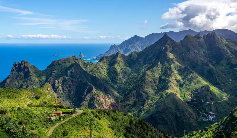
The south coasts sit in the lee and keep the sun. Tenerife makes the point with its two airports. Tenerife North, at Los Rodeos, sits 632 m up on the windward side. It gets 516 mm of rain on 62 days a year and about 2,080 hours of sunshine: more than four times the rain of Tenerife South and a third less sun. Some of that is altitude, but it is the honest version of "the north is cloudier". Base yourself on a north coast and you trade some sunshine for greenery and town life.
Altitude is a climate of its own. Teide, at 3,715 m the highest mountain in Spain, can get snow on some winter days. AEMET's Izaña observatory at 2,371 m, above the cloud lid, averages 8°C by day and 2°C at night in January, and logs 3,737 hours of sunshine a year, more than any of the airports. You can swim in the morning and need a proper coat in the national park in the afternoon.
Calima: the Saharan dust
Calima is Saharan dust in the air, and it behaves differently by season. A study led by AEMET's Izaña Atmospheric Research Centre, using lidar and weather-balloon profiles over the islands, found that in summer the dust usually rides high, in a layer reaching about 6 km, while the cool, moist marine layer underneath acts as a barrier (Barreto and others, 2022). In winter the trade winds are weak and the dust comes in low, below about 2 km, mixed into the air you breathe. Those low episodes are the ones that close airports.
The worst in recent memory began on 22 February 2020. Winds gusted to 120 km/h, visibility fell to tens of metres in places, and every airport in the islands closed, most of them until the 24th. Close to 800 flights were cancelled or re-routed (NASA Earth Observatory). In February 2021, during another episode, a monitor at the Santa Cruz de Tenerife observatory recorded PM10 above 700 µg/m³ (AEMET's blog). Episodes typically last several days. If one is forecast around your flight, build in slack, and see the calima explainer for what it does to views and lungs.
Swim or not, month by month
The water never gets as cold as the winter Mediterranean, and never as warm as the Mediterranean in August. Below, "west" means the water off Tenerife South and south Gran Canaria, and "east" means Lanzarote and Fuerteventura. The comparisons with other seas use AEMET's marine atlas.
- January: about 20°C in the west, 19°C in the east. Swim, briefly. That is warmer than the sea south of Madeira (18–19°C) and far warmer than the western Mediterranean (14°C west of the Balearics).
- February and March: the coolest water of the year, 19°C in the west and 18°C in the east. Swim if you like it fresh. For long soaks, a heated pool is the honest answer.
- April to June: warming slowly, from 19°C in April to 21°C in June, a touch warmer than the open sea off the Costa del Sol in June (20°C). A proper swim, if not a warm one.
- July and August: 22–23°C in the west, 21–22°C in the east. Pleasant, but three or four degrees cooler than the western Mediterranean in August (26°C west of the Balearics).
- September and October: the warmest water of the year, 23–24°C in the west and about 23°C in the east. If the sea is the point of the trip, come now.
- November: 22°C in the west, 21°C in the east, still warmer than any month from January to June.
- December: 21°C in the west, 20°C in the east, and cooling.
For the safety side of cold-water swimming, and the questions to ask a hotel about its heated pool, read our winter sea-swimming guide.
About these numbers
Air temperature, sunshine and rain are 1991–2020 normals for AEMET's four airport stations, as Spain submitted them to the World Meteorological Organization. AEMET's own station pages still show 1981–2010. For Gran Canaria and Fuerteventura the two periods agree within about half a degree. Tenerife South and Lanzarote don't: their newer daytime highs run up to a degree warmer, and Tenerife South logs 20–35 more hours of sun a month. Twenty of the thirty years are shared, so a warming trend alone can't explain a gap that size, and the pages we used don't say what changed. Treat half-degree or half-hour differences between islands as noise.
The sea temperatures are NOAA's 1991–2020 monthly averages from its OISST analysis, for one grid cell off each island. They describe the open sea roughly 10–25 km offshore, not the water at your beach on a given day. Our destination pages forecast the weather, not the sea, so check the water separately before a swimming trip.
For what a winter week there actually feels like, read our guide to the Canaries in winter. For the next fortnight, the destination pages carry the live forecast: Tenerife South, Gran Canaria, Lanzarote and Fuerteventura.